Flood Watch Mattawa River
A FLOOD WATCH remains in effect for the Mattawa River, downstream of Hurdman Dam to the Ottawa River. The Watershed Conditions Statement – Flood Outlook previously issued for the remainder of the North Bay–Mattawa watershed has ended.
“Water levels remain elevated in the lower reaches of the Mattawa River due to high flows from upstream tributaries to the Ottawa River. Flooding is expected to persist where it is already occurring Water levels in the Mattawa area remain above normal and minor flooding is occurring in low-lying areas,” said Angela MillsGithan Kattera, NBMCA Flood Duty Officer. “Water levels in the remainder of the watershed in local rivers have peaked and are near normal for this time of year.”Water levels on the Mattawa River are expected to remain high due to continued high flows on the Ottawa River.” The Mattawa River downstream of Hurdman Dam is directly influenced by Ottawa River levels.
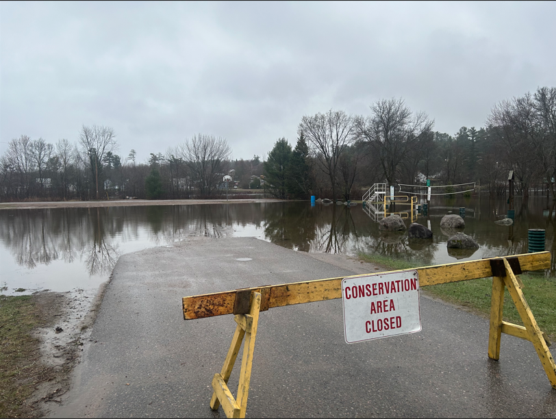
Limited precipitation is forecast for the coming week, with up to 20 mm of rain locally possible Friday (May 16) into Saturday. Mattawa Island Conservation Area is currently flooded and has been closed to the public until further notice.
Rainfall amounts are expected to remain low, with up to 10 mm forecast over the next five days. While water levels are not anticipated to rise significantly, localized flooding may continue where it is already occurring.
The Mattawa Island Conservation Area is currently flooded and has been closed to the public until further notice.
The public is encouraged to keep children and pets away from watercourses and shorelines. Area residents and visitors, especially those in low-lying areas, are encouraged to monitor the conditions as they develop and take proper precautions during times of high flows. If you have a flood emergency, please contact your municipality. If you live in an unincorporated township, please contact the Ministry of Natural Resources and Forestry – North Bay District.
As part of the NBMCA Flood Forecasting and Warning Program, staff will continue to monitor weather and watershed conditions and update this message if needed based on the changing weather/streamflow conditions. Staff remain in contact with municipalities and other partners as required.
This message will be in effect until Tuesday, May 2013, 2025, at 4:00 PM EDT.
Terminology: Notification Levels
WATERSHED CONDITIONS STATEMENT: general notices of potential flooding or other conditions that pose a safety risk. There are two kinds of statements:
Water Safety indicates that high flows, unsafe banks, melting ice or other factors could be dangerous for users such as anglers, boaters, swimmers, children or pets. Flooding is not expected.
Flood Outlook gives early notice of the potential for flooding based on weather forecasts calling for heavy rain, snow melt, high wind or other conditions that could lead to high runoff, cause ice jams, lakeshore flooding or erosion.
FLOOD WATCH
FLOOD WATCH notifies that the potential for flooding exists within specific watercourses and municipalities. Municipalities, emergency services and individual landowners in flood-prone areas should prepare.
FLOOD WARNING
FLOOD WARNING notifies that flooding is imminent or already occurring in specific watercourses or municipalities. Municipalities and individuals should take action to deal with flood conditions. This may include road closures and evacuations.