
Snow Depth Increased by 11.5 cm
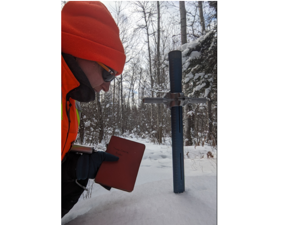
Snow depth increased by 11.5 cm and snow water equivalence by 23.0 mm since January 2 and is considered normal for this time of year at all sites, reports the North Bay-Mattawa Conservation Authority who measures snow depth and water content as part of its Flood Forecasting and Warning Program.
Port North Bay Virtual offices advantages for business just $50 per month
Snow is measured for depth and water equivalence at three locations in the watershed.
North Bay Golf and Country Club (Chippewa Creek Watershed, North Bay)
*Data prior to Dec. 2011 collected at the former Northeast Mental Health Centre, Hwy 11
|
Current Snow Depth for January
15, 2025 |
22.4 cm (normal) |
|
Current Water Equivalence
for January 15, 2025 |
54.0 mm (normal) |
|
Snow Depth last year for January
15, 2024 |
21.7
cm |
|
Normal Snow Depth |
21.5
cm to 37.2 cm |
|
Highest recorded snow
depth for January 15 since 2012* |
51.6
cm in 2019 |
Corbeil Conservation Area (La Vase River Watershed, Corbeil)
|
Current Snow Depth for January
15, 2025 |
26.3
cm (normal) |
|
Current Water Equivalence
for January 15, 2025 |
54.0 mm (normal) |
|
Snow Depth last year for January
15, 2024 |
27.1
cm |
|
Normal Snow Depth |
26.3
cm to 42.7 cm |
|
Highest recorded snow
depth for January 15 since 1988 |
63.0 cm in 2009 |
Shirley Skinner Conservation Area (Kaibuskong River Watershed, Chisholm)
|
Current Snow Depth for January
15, 2025 |
28.9 cm (normal) |
|
Current Water Equivalence
for January 15, 2025 |
59.0 mm (normal) |
|
Snow Depth last year for January
15, 2024 Normal Snow Depth |
29.6 cm 25.1 cm to 39.0 cm |
|
Highest recorded snow
depth for January 15 since 2007 |
57.9 cm in 2019 |
Hot Jennifer Tocheri