Flood warning issued for Lake Nipissing shoreline in North Bay and Callander
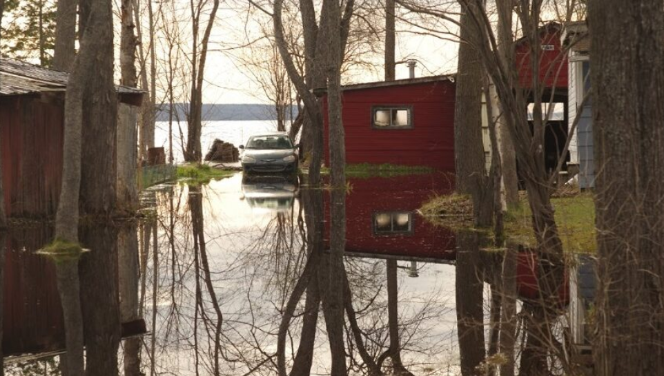
The North Bay-Mattawa Conservation Authority (NBMCA) says conditions on Lake Nipissing in the coming weeks may be comparable to 2019 flood levels.
Officials say the water level of the lake has been rising rapidly and is expected to continue to rise as snowmelt continues, adding significant snowpack remains in the northern areas of the Lake Nipissing watershed.
They say right now it’s about 43 cm below the level the lake was at during the ‘historic lake-based flooding’ in May 2019.

“Public Services and Procurement Canada is forecasting Water level on Lake Nipissing to exceed non-damage levels in the next couple of days,” states the NBMCA’s latest flood update, issued at 4 pm on April 21. “The changes to water levels on Lake Nipissing depend on the amount of water flowing in from rivers, precipitation, and the amount of water flowing out through the control dams to the downstream French River.”
A flood warning is in place for the North Bay-Mattawa watershed and Lake Nipissing Shoreline in North Bay and Callander.
A flood watch is in place for the Mattawa River downstream of Hurdman Dam.
Both are in effect or will be updated by 4 pm on April 28.

Looking back to 2019, a provincial report says that year saw severe flooding on Jocko Point with 60,000 sandbags deployed and Nipissing First Nation preparing to evacuate residents if needed, a state of emergency in West Nipissing with damage to municipal infrastructure and very high-water levels in low-lying areas of Callander and Nipissing Township.
In North Bay, the city installed pumping equipment at the wastewater treatment plant and closed boat launches, while the Conservation Authority had the Parks Creek Backflood Control Structure pumping for weeks.

In the first two weeks of this month, NBMCA says more than 220% of normal April precipitation has been recorded at the North Bay Airport.
Officials say around the watershed, water levels and flows have increased significantly, noting area lakes remain ice-covered.
“Ongoing flooding is occurring along the La Vase River, Wasi River, and Mattawa River upstream of Hurdman Dam and its tributaries, including Trout Lake, Turtle Lake, Lake Talon,” states the update. “Water levels in local watersheds have plateaued and have begun to recede in most areas. Corbeil Conservation Area and Mattawa Island Conservation Area remain closed due to flooding.”
NBMCA says there is minimal precipitation in the forecast for the coming week, which will allow floodwater to continue to drain through the watershed.
Temperatures are forecast to be above freezing for the coming week.
In Mattawa, officials say water levels and flows are above normal for this time of year and are expected to reach minor flood thresholds in the coming days.
They say the risk of further increase in levels over coming weeks is higher from Mattawa and downstream given the high snowpack remaining in the northern part of the basin.
The Conservation Authority says all residents, especially those in low-lying areas, are encouraged to monitor the conditions that are developing,

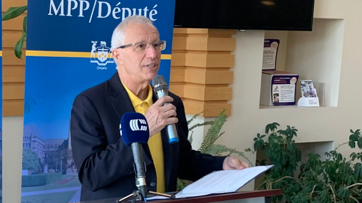
Richard Coffinhttps://www.mynorthbaynow.com/Richard Coffin has been a reporter and news anchor on the radio in North Bay for over 25 years. From premiers to people in the neighbourhood, he enjoys connecting with newsmakers and writing stories that matter to area listeners on a variety of topics including healthcare, education, politics, sports and more.